Hiking routes and nature trails in Cyprus
How to choose an official trail in Cyprus, assess the difficulty, weather and fire risk, and prepare water, navigation equipment and a safe return plan.
Checked: 23 September 2026.
How to read an official map
The Ministry of Tourism and the Department of Forests publish maps and information sheets for nature trails. For each trail, check the area, the type of route – linear or circular – the length, the estimated time, the elevation gain and the level of difficulty. The time figure is a guide for dry trails and well-prepared visitors, not a guarantee that you will return by a specific time.
The name displayed on the sat-nav sometimes leads to a place of interest, a village or the opposite end of a linear route. Before setting off, check the exact coordinates of the starting point, parking facilities and how you will return. For a linear route, decide in advance whether to walk back the same way, leave a second car there or book a transfer.
An official listing does not mean the trail is open every day. Heavy rain, landslides, fires, forestry work or maintenance may temporarily close a section. Check the latest announcements from the Department of Forests and the on-site signage; a closed barrier and tape are more reliable than a saved PDF.
Areas and nature of the routes
In the Troodos Mountains, there are high-altitude routes around Olympos, waterfalls and pine forests. It is cooler here in summer than on the coast, but snow, ice and fog are possible in winter. The Artemis and Atalanti trails are renowned for their panoramic views, though the altitude is noticeable, and weather conditions at the summit differ from those in Limassol or Nicosia.
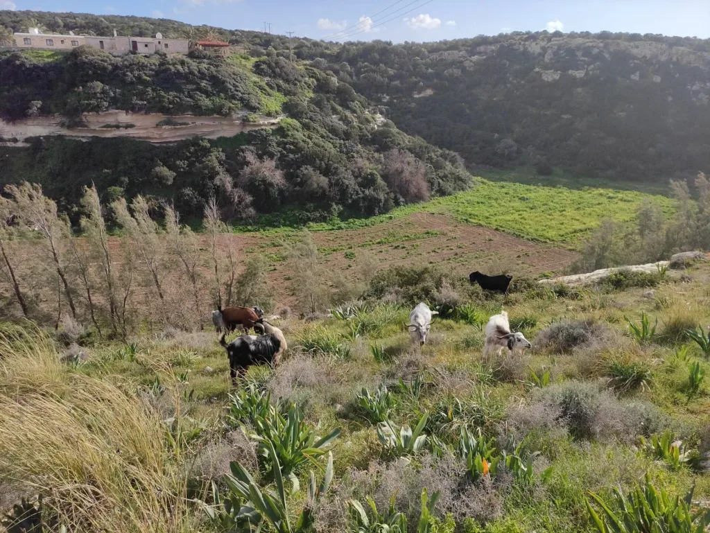
On the Akamas Peninsula and the west coast, the routes combine limestone slopes, gorges and the sea. The Avakas Gorge is dependent on the condition of the riverbed: after rain, the rocks are slippery, and falling debris is more dangerous than a beautiful photograph. The coastal wind and lack of shade require no less preparation than a mountain ascent.
Cape Greco, the salt lakes, the Maheras Forest and rural areas offer shorter options. Don’t choose a route based solely on the number of kilometres: an exposed, rocky stretch under the sun can be tougher than a long forest path. Compare the elevation gain, surface, shade and potential exit points.
Season, weather and start time
Spring is ideal for flowers and cool slopes, autumn for moderate temperatures, whilst in winter precipitation and short daylight hours are particularly important. In summer, low-lying, open trails heat up quickly. The city weather forecast does not cover the gorge or the summit, so check warnings from the Meteorological Office and local conditions.
Set off with plenty of time to spare before dark, allowing for stops and the return journey. During hot spells, the early morning is safer, but even then you’ll still need water and sun protection. If there is a warning of extreme heat, thunderstorms, strong winds or a fire risk, the route should be shortened or cancelled.
After rain, water can render a dry riverbed impassable, and the dirt track leading to the start of the route may become inaccessible to a standard car. In winter, ice may form at higher altitudes. Do not try to ‘make up for lost time’ by speeding up on wet rocks; turning back before reaching a dangerous section is a perfectly acceptable way to end the hike.
Water, clothing and navigation
The amount of water required depends on the heat, the workload and the individual; natural water sources should not be regarded as guaranteed or safe. Bring your own supplies, food, a hat, sun cream, closed-toe shoes with grippy soles, a light extra layer and a basic first-aid kit. Alcohol and hiking in hot weather do not mix.
Download an offline map, save the coordinates of the starting point and key junctions, but do not rely on a single mobile phone. A fully charged phone, a cable and a power bank are more useful than constantly taking photos. Trail markings may have faded or been damaged; if the route shown on the app differs from the official markings, stop and double-check your position.
Clothing should protect you from the sun, prickly plants and sudden changes in the weather. After your walk, check your skin and clothing for ticks. Do not touch snakes or wild animals, do not feed them or try to move them; give them a clear path to retreat and calmly step back.
Fires and forest regulations
Before entering the forest, check the current fire risk level and any closure notices. A campfire, torch, cigarette butt, firework or any tool that produces sparks can start a fire. Prepare food only in places and in ways that are officially permitted; the absence of a patrol does not make a dangerous activity permissible.
If you smell smoke, do not go looking for the source. Head towards a safe road, avoid narrow gorges and slopes downwind, and call 112 or 1407 from a safe location. Report the location and direction of the smoke; do not fly a drone and do not block access for the emergency services.
Take all rubbish away with you; leave plants, stones and archaeological artefacts where they are. Follow the marked route, close gates as you found them, and respect private property. Keep your dog under control; check in advance whether pets are allowed on a particular trail.
Communication and return plan
Before setting off, tell a friend the name of the trail, the starting point, the group members, your car and the scheduled time for your next contact. This is more important than posting your geolocation on social media: rescue teams need a specific plan. Once you return, be sure to let them know that the route has been completed to prevent a false search from being launched.
Mobile network coverage in mountainous terrain is unreliable. Save the number 112 in advance, but remember that a phone call is no substitute for the decision to turn back. If someone is injured, assess the risk of falls, falling rocks, water and fire; do not move them unless absolutely necessary, and provide the operator with their coordinates and the nature of the injury.
A solo hike requires a more conservative route. The group stays together and moves at the pace of the slowest member. For children, elderly people and those with chronic conditions, the route’s length, shade and access to assistance are selected in advance, rather than suggesting they ‘give it a go and see how it goes’.
Pre-trip checks
First, choose an official trail and save its up-to-date map. Then check the weather, fire risk and any closures, and work out daylight hours and transport arrangements. Tell a friend or family member your plan, charge your mobile phone and take water, sun protection, suitable footwear and a first-aid kit.
At the start, read the information board again: conditions may have changed since you made your preparations. If the route is closed, the weather has taken a turn for the worse, a member of your group is feeling unwell, or your water supply is running out faster than planned, turn back. Neither a summit, nor a waterfall, nor a photograph is worth continuing on an unsafe route.
This guide helps you plan your walk, but is no substitute for official announcements or assessing conditions on the ground. Sources were checked on the date indicated; maps, access and restrictions may have changed. Check these details again before every outing, even if you have walked this trail before.