Cyprus’s waterfalls: walking trails, seasonal information and safe access
How to find the official entrance to the footpath leading to the waterfall, assess water levels depending on the season, the difficulty of the route and conditions after rain.
Checked: 27 September 2026.
The waterfall is part of the route, not a point on the map
A trip to a waterfall in Cyprus begins with choosing an official trail and knowing the way back. The name on the map does not indicate where entry is permitted, how far you’ll have to walk, or whether there is water at that time of year. The Department of Forests publishes information on nature trails, including the trail to Millomeri Waterfall; be sure to check the most up-to-date description of your chosen route.
Compare the length, linearity and difficulty. On a linear trail, once you’ve reached the waterfall, you’ll have to retrace your steps unless there’s an authorised exit on the other side. The time given on the route card usually refers to a normal pace, not to a long photo session or a walk with small children. Allow extra time before it gets dark.
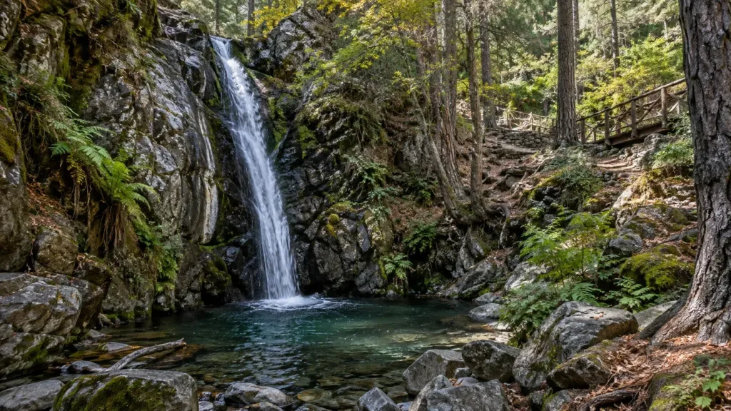
Don’t expect a powerful cascade based on a spring photograph, either for yourself or your companions. The amount of water depends on the season and rainfall. Even when the cascade looks more modest than expected, the forest and the riverbed are still well worth seeing; do not look for a ‘secret’ path off the trail leading to an inaccessible waterfall basin.
Millomeri and other forest trails
The official description of the Millomeri Trail specifies its starting point, linear route and high level of difficulty. This provides a useful basis for planning, but the trail conditions and access may have changed since publication. Before you set off, check the entry point, parking facilities and any restrictions; once there, follow the signposts rather than a random navigation point.
Other waterfalls and seasonal streams may be located on routes managed by a different authority. The Cyprus Department of Forests makes a clear distinction between trails within state-owned forests and those outside them: the latter may be the responsibility of local authorities. Therefore, rules and current contact details cannot automatically be applied from one location to another.
If the waterfall’s common name appears in a travel blog, check that it matches the official name of the trail and its starting point. Do not confuse the road leading to the viewing point with the walking route along the riverbed. Doing this research before your trip helps to avoid unnecessary risks and ensures you respect private property.
Seasonal variations in water levels and the weather
After rain, the water may be more visible, but at the same time the stones, bridges and earthen steps become slippery. A heavy downpour further up the slope can change conditions along the stream bed, even if it was dry at the start of your walk. Do not approach the water’s edge just to get a photo, and do not cross the stream unless there is a designated, safe crossing point.
In summer, the waterfall may become less powerful, whilst the heat along the open approach may intensify. Choose a time and a water source suitable for the whole group, without relying on the spring by the path as a drinking water source. If the sole purpose of the trip is swimming, check in advance whether it is permitted at all; the presence of a pool beneath the cascade in the photo does not constitute permission.
The weather in the mountains can be different from that on the coast. Before setting off, check the forecast and the time of sunset, and alter your route in the event of a thunderstorm, strong winds or a warning. A ‘quick out-and-back’ plan does not eliminate the risk if a narrow section is already slippery or the path is officially closed.
Footwear, group and the way back
You’ll need footwear that provides a secure grip on uneven and wet surfaces. Beach sandals are often uncomfortable on rocks and dirt; test your choice on a real trail. Take water, a hat, a light warm layer and a fully charged mobile phone. Save an offline map and agree on a time to turn back.
The pace is set by the person who finds it hardest to walk on the steps and rocks. Do not separate children from adults just to take a photograph, and do not leave anyone by the water who is unsure about making the climb back up. If the group is tired before reaching the waterfall, turning back is a perfectly valid and sensible way to end the walk.
When planning accessibility, don’t just look at the overall length. Slopes, steps, wet stones and a lack of handrails can make even a short route unsuitable. Check with the relevant authority for specific requirements rather than assuming that ‘just a short distance’ will suit everyone.
Nature around water
Streams and damp areas support plants and animals that are sensitive to trampling. Stay on the marked path; do not pick plants or move stones just to get a better shot. Even if the bank appears solid, repeated trampling by visitors causes erosion and damages the narrow strip of vegetation.
Please do not leave rubbish, wet wipes or food waste behind. Choose a designated picnic area, if available; near a waterfall, it is best to keep the narrow path clear for other visitors. Loud music and drones can disturb the peace of both animals and people, and filming regulations vary depending on the area.
If you see a damaged fence or a hazardous area, please report it to the relevant authority. Please do not post advice on how to get round the closure. Temporary access restrictions may be in place to protect both visitors and the environment following bad weather or maintenance work.
How to check route details
Before setting off, visit the Department of Forests’ website to find out who manages a particular trail. Then check the weather forecast, access details and any notices regarding closures. If your old guidebook and the sign at the entrance differ, follow the sign and check with the local authority for further details.
Save the name, starting point and route type, but do not rely on a single geotag without a description. The navigation may lead you to the end of a linear path, a private driveway or an undeveloped shoreline. Check the location against an official map and make sure there is space to turn your car round safely.
After your visit, note down the actual time, the condition of the trail and the availability of water. These observations will help you plan a return visit, but do not guarantee that conditions will be the same in another season. Please exercise particular caution when sharing information about unofficial trails: publicising them poses a risk to both people and the natural environment.
What a safe decision means
If the entrance is closed, the riverbed is flooded or the terrain is unsuitable for your group, choose another authorised walk. The trip isn’t ‘ruined’ if the route is altered to avoid a dangerous section. For families and beginners, a pre-planned alternative reduces the pressure to reach the waterfall at any cost.
Sources were checked on 27 September 2026. Water flow, roads, footpaths and site regulations may change in the space of a single day; these should be checked immediately before setting out. This article does not guarantee access to a specific waterfall and is not a substitute for guidance from the relevant local authority.
This guide helps you choose and check your route, but does not provide a personalised assessment of your physical fitness. In the event of an injury, a sudden change in the weather or any other danger, stop your walk and seek help as appropriate.
Continue planning
- Skiing holidays in Troodos: the season and checking the conditions
- The Flora of Cyprus: Natural Zones, Endemic Species and Conservation
- Rock climbing in Cyprus: areas, access and safety