The Kantara Castle, Kyrenia, Morphou, Pyrgos
After visiting the Monastery of Apostle Andrew on the eastern cape of Cyprus, we returned to the roundabout near Leonarisso. From there, after turning right, we started moving along the northern shore of the island. This is a new, recently built, coast road which is why it’s not marked on many maps of Cyprus.
You do not have to be romantic to admire the beauty of the landscape. The mountains border the sea shore very closely. Huge rocks hang right over the road. This region is still sparsely populated, which is why we only saw 2 petrol stations on the whole stretch of road, which is 140 km long, from the Apostle Andrew to Kyrenia.
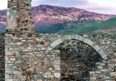
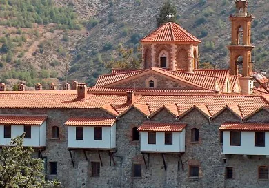
The Kantara Castle

You can clearly see the Kantara fortress from here, from the road at the very beginning of the Kyrenia ridge. Shrouded in mist, it simply draws you by its mysteriousness.
You should turn right next to the Davlos settlement to get there.
Тhe exact date of construction of the castle is not known, but people think that it, like the Saint Hilarion castle, was built by the Byzantines in the 10th century to protect the island from Arab raids.
History interweaves the culture, language and the legends of different peoples between themselves in a most interesting way.
It is known that the fortress was erected in place of the Monastery of Our Lady the Kantarotissa. A chapel, which has been preserved, testifies to this fact.
The name of Kantara given to the fortress by the Lusignans, means bridge or arc in Arabic. It characterized the form of a mountain on which the castle is located.
Like any medieval castle, Kantara has legends of its own. Оne of the local legends says that there used to be 101 rooms in the castle and when someone entered the 101st room, he found himself in a paradise and was unable to return to the castle through the door. It is also believed that if you look at it long enough you will see, at the very top window, a mysterious Queen, who lived in the castle 500 years ago.
 Kyrenia

But we have to move further, because we still have more than half way to go. We covered an 88 km stretch from Leonarisso to Кyrenia in 1 hour and 20 minutes, and we arrived at Kyrenia just in time for lunch. There were many cars in the central streets of the city which really slowed our progress.
We approached the centre of the city via Ugur Mumcu Street and passed a large monument to liberty.
I could find no information on whose liberty the monument was devoted to.

Now hungry, we stopped next to one of the pedestrian streets near the embankment. Crowds of tourists were strolling unhurriedly amongst these street cafes and little restaurants, and we settled ourselves in one of them. Lunch consisting of a hamburger with salad and freshly squeezed juice cost us 35 Turkish liras, which amounts 12.5 еuros.
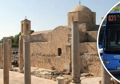
You can read about the main Kyrenian sights, such as the Кyrenia fortress, the embankment and a museum of shipwrecks HERE.
Those who wish may visit a museum of icons, located in the church of Archangel Michael. In fact, this is the whole list of the most interesting touristic places of the city with the exception of the fashionable casinos and evening entertainment, which are numerous here.
When leaving the city, we passed the museum of Peace and Liberty. Our eyes were drawn by a modern stela, which decorated the entrance to the museum.
Morphou
 Our next stop was in the city of Morphou after travelling west for another 40 km.
A settlement on this site appeared as far back as the Byzantine period. Мany islanders, trying to flee the Arab raids, came here and started building homes next to the church of Saint Mammas.
Morphou received the status of a city during British colonization in 1883. A railway, which was built between Morphou and Nicosia, gave a new impetus to the development of the city.
Before the events of 1974 the inhabitants of the city were primarily Greek and Orthodox. After the Turkish army seized the north of the island, мany inhabitants of the city had to leave their homes. The bishop of Morphou was also forced to flee the city.
Since then there have been no church services in the church of Saint Mammas, which is still located in the centre of the city and has since become a museum.
It’s interesting that even before the military actions, the Turkish name of the city sounded similar to the Greek, pronounced as Omorfo, but in 1974 the new authorities renamed the city Guzelyurt.
There are several Turkish military bases stationed both inside the city and beyond it now. This is why, despite the seeming calm, the topic of the division of the island is still pressing.
The Border with the Greek Part of Cyprus

After travelling for another 40 km, we arrived in the village of Pyrgos, where we crossed the border and returned to the Greek part of the island.
We skirted the village of Kokkina – a small isolated area which is under control of the Turkish army. This is a military station and there is not a single civilian living there anymore.
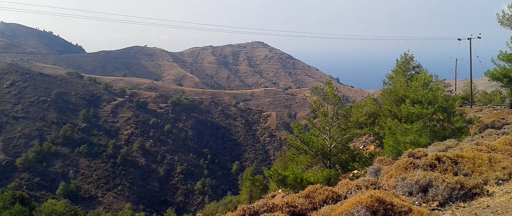
The scenery of the western mountains is much brighter than that of the Troodos Mountains. There is the rich greenery of the trees and strong thick pines.
A magnificent view of the sea opens out from the mountain road. The sun, the sea and the mountains – here it is, the harmony of nature!
Having covered almost 400 km in one day, which accounts for 2/3 of the whole route, we stopped in one of the hotels of the Polis city for the night.